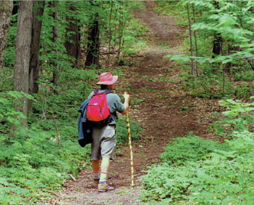
Hiking Trails
- James River Heritage Trail
- Virginia Blue Ridge Railway Trail
- Appalachian Trail
- Henry Lanum Memorial Trail
- Old Hotel Trail
- Mount Pleasant National Scenic Area
- Virginia Girding & Wildlife Trail
James River Heritage Trail
About The Trail:
This Blacktop hiking/biking trail is currently accessible from Percival's Island Natural Area. The Trail Extends from Lynchburg's Blackwater Creek Trail, crossing the railroad trestle onto Percival's Isle from Lynchburg. It traverses the island for about one mile along an old railroad bed. The trail continues across the James River on another trestle, and continues along the James River in Amherst County for another 1 1/2 miles. This is a beautiful scenic walk or bike ride through an historical area. The trail is accessible in Amherst County at the end of Fertilizer Road (Central Virginia Training School).
Virginia Blue Ridge Railway Trail
About The Trail:
This trail is idylically located in the rolling Virginia countryside and follows the backs of the Piney and Tye Rivers along the path of the longest running, commercially successful short-line railway in America. It provides a perfect opportunity to relive the historically significant events that developed and changed Amherst and Nelson Counties. It Extends approximately 7 miles in both Amherst and Nelson Counties for hikers, bikers, and horseback riding. The two access point are located at Piney River and Roses Mill.
Appalachian Trail
Directions:
Approximately 25 miles of this trail passes through Amherst County from the Nelson County line to the James River and across the James River Foot Bridge. There are many beautiful and scenic trails that run through the mountains of the county. Enjoy the sights from Mt. Pleasant, Cole Mountain, Tar Jacket, Rocky Row Run..
Henry Lanum Memorial Trail
Directions:
Located in the Mount Pleasant National Scenic Area, this 4.8 mile loop leads to the 4,071 foot summit of Mount Pleasant with panoramic 360 degree view.
Old Hotel Trail
Directions:
A 5-mile loop (When combined with the Appalachian Trail) across the meadows on the summit of Cole Mountain with fantastic views of the Amherst foothills and the western valley.
Mount Pleasant National Scenic Area
Directions:
From traffic circle head 60 East (Richmond Highway) approximately ½ mile and turn right onto Route 29 South. Follow Route 29 on the new bypass until you reach Route 210 (Old Town Connector). Turn Right on Route 210 and go to Route 622 (Wright Shop Road) at the first stop light. Turn right onto Route 622. Follow Route 622, it will change from Wright Shop Road to Galts Mill Road to Stapleton Road. Go approximately 1 mile past the Grief Brothers entrance to Route 600 (Riverville Road). Turn left onto Route 600 and follow to Route 60 Richmond Highway). Turn left on Route 60 and go approximately 6 miles to the traffic circle. Trip distance 43 miles, approximate time 1 ½ hour plus stops
Virginia Girding & Wildlife Trail
Directions:
From traffic circle head 60 East (Richmond Highway) approximately ½ mile and turn right onto Route 29 South. Follow Route 29 on the new bypass until you reach Route 210 (Old Town Connector). Turn Right on Route 210 and go to Route 622 (Wright Shop Road) at the first stop light. Turn right onto Route 622. Follow Route 622, it will change from Wright Shop Road to Galts Mill Road to Stapleton Road. Go approximately 1 mile past the Grief Brothers entrance to Route 600 (Riverville Road). Turn left onto Route 600 and follow to Route 60 Richmond Highway). Turn left on Route 60 and go approximately 6 miles to the traffic circle. Trip distance 43 miles, approximate time 1 ½ hour plus stops